The heavy rains recorded earlier this month in the Venezuelan city of Las Tejerías, south of Caracas, led to major flooding and landslides that claimed the lives of dozens and left at least 50 missing. The region was hit with more devastating news as at least another 28 people died and thousands more were evacuated when Hurricane Julia made landfall in several Central American countries, including Nicaragua, Guatemala and El Salvador.
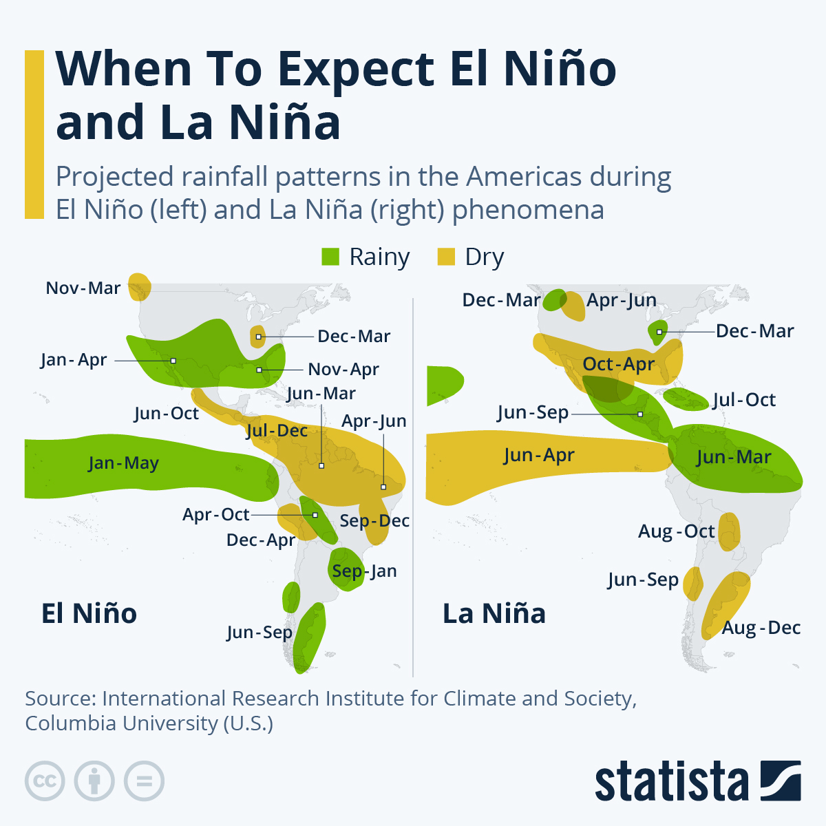
Both tragedies are, to a great extent, a consequence of the phenomenon known as “La Niña.” As this map shows, using data from the International Research Institute for Climate and Society at Columbia University, climatic conditions during La Niña result in increased rainfall in northern South America, Central America, and the Caribbean, and dryer periods in Chile, Argentina, Uruguay and southern Brazil.
El Niño and La Niña are both a part of the global climate cycle known as the El Niño-Southern Oscillation (ENSO). El Niño is produced by the warming of the equatorial Pacific waters, while La Niña is what happens in the cooling phase. When it comes to El Niño, the extreme south of South America can expect to experience heavier rainfall, leading to higher water levels. Meanwhile, in the north of the subcontinent and much of Central America and the Caribbean, the lack of rainfall means droughts and a higher risk of forest fires are far more likely.


